Modeling the AT&SF - D&RGW Joint Line through Colorado Springs from Milepost 70 to Milepost 80 circa 1978-1979
- ~ -
Post 12: Pikeview: Laying out the Santa Fe and Rock Island, Part 1
Yet another planning post?
I know, just what I need, yet another diversion, right? But after I mentioned in the Trains and Traffic post that the Rock Island had quite a few customers in an industrial park in Roswell on the north side of the Springs I just couldn't resist dragging out the long sheet of cardboard on which I'd already drawn a plan for that trackage. It is not shown on the layout plan, but the name is there where it could be.
Basically it would be a long, stub-end peninsula coming off the RI staging track along the wall outside the layout room. And it wouldn't just be for the RI tracks to the industrial park, it would also host the isolated piece of the old Santa Fe mainline used as a switching lead to reach several still active customers, giving both switch jobs more work to do.
You can see just how easily my attention wandered, can't you?
Anyway, since I already had a stack of building mock-ups and several drawers of freight cars and locomotives handy from mocking up the rest of the layout, it was all too easy so out they came. At least I was having fun, even if I wasn't laying down track in the staging yards.
So, the physical track layout up at Pikeview looked like this:

ATSF notes and customers in red, RI notes and customers in light blue
(click on image to enlarge, I suggest you open it in a new window to zoom in)
The vestige of the northbound Santa Fe main is on the west, running 1.4 miles right beside N. Nevada Avenue after crossing over the Rock Island main. That bridge was removed, completely isolating this trackage. To the east is the first of three Rock Island switching leads swinging north off their mainline. It curved sharply and climbed steeply to cross Fillmore Street and run right beside the Santa Fe a short ways before making an S-curve to reach several customers, at one time continuing just under a mile to north of Nichols Blvd.
To get to their their now isolated track the Santa Fe reached a deal with the Rock Island to use the RI mainline through Roswell, and then the RI switching lead to tie into the old Santa Fe main just below Fillmore Street. In return, the Rock was allowed to use a short stretch of the Santa Fe track across Fillmore, and then divert back onto their own track. This resulted in only one flasher-protected grade crossing across Fillmore, which was being rebuilt and widened at the time. Win-win-win for both railroads and the City.
So what customers justified all this. From the south the Santa Fe served two drywall companies, Building Specialties and Drywall Supply, two petroleum distributors, Amoco and Texaco, a team track, LPG distributor Empire Gas, a branch Transit Mix batch plant, and the Miller beer distributor, High Country Sales.
On the Rock Island lead there was the very large El Paso County Lumber Co. yard (later Brookhart Lmbr, currently Foxworth Galbraith), the smaller Everitt Lumber Co., Pike's Peak Distributing, the Budweiser franchise until it moved over to Russina on the Rio Grande, a couple warehouses, and CSDPU's Birdsall gas-fired power plant, although it didn't get anything in by rail after construction was completed. The lead was then cut back to the lumber yard.
My plan is to model this Santa Fe and Rock Island trackage on one side of a 14 foot long, 36 inch wide peninsula. On the other side will be an amalgamation of the other two Rock Island spurs, but I'll get to that in Part 2. Running down the middle of the peninsula will be a long row of buildings serving as both the rail customers and as a view block to separate the peninsula into two distinct scenes within the same industrial park. These buildings will be finished and detailed for different customers on opposite sides.
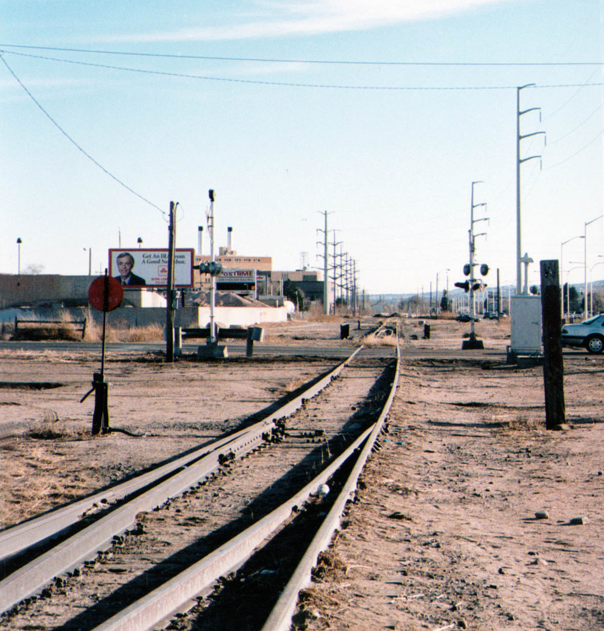
And here is what the area looked like on the ground, and what the west side of the peninsula might look like.


No comments:
Post a Comment