Tuesday, March 4, 2025

Laying out the Rock Island industrial park lead


Modeling the AT&SF - D&RGW Joint Line through Colorado Springs from Milepost 70 to Milepost 80 circa 1978-1979

- ~ -

Post 13: Laying out the Rock Island industrial park lead, Part 2

- ~ - 
 
And now for the other side of the Peninsula, but first, here are couple photos to enjoy of the Rock Island switching leads being worked in later years by a D&RGW GP40, albeit patched with it's new UP number: 
 
UP 1445 heading up the Rock Island main in 2009 with a cut of loaded centerbeams for Foxworth Galbraith (El Paso County Lmbr). And returning with empties. Note the trainman riding the end car as this is a shoving move.

To the east of the first Rock Island switching lead are two more. Make that three, since the middle one splits into two separate leads north of Fillmore St. The industrial park that they served was laid out in the late 1940s on an old airfield and grew steadily through the 1950s and early 1960s, filling in with low-rise light manufacturing, warehousing and wholesale distributing firms. No major large industries here, and I don't think there was a single two-story building among them.

Customers on the main center lead and its west fork included Timken's Rock Drill Bit Division (remember, hard rock metal and coal mining is very big business in Colorado), a carburetor manufacturer, a concrete block manufacturer, the local Canada Dry bottler, a good size Sears furniture and appliance warehouse, a small printing plant, a Maytag warehouse, a team track, a telephone pole yard, and the Pepsi Cola bottler. The east fork served two roofing contractor-distributors, a machinery company, a produce distributor, a PPG glass distributor, a waste cardboard recycler, and a couple miscellaneous warehouses.

The third (fourth) lead further east is very short, not even reaching Fillmore St, and only served yet another drywall distributor and yet another small lumber yard.

I chose to focus on the center east fork as it runs up an alley between N Century St and N El Paso St, flanked on both sides by parallel customer spurs and buildings, creating sort of a low-rise urban industrial canyon. Actually, I blended the two forks a bit, moving some customers around to better fit my scheme of the center building view block, and to yield a good mix of customers, buildings, and car types. There was plenty to choose from as I selected which ones to locate along my single lead track.

Here's the layout of the center Rock Island leads:

(click on image to enlarge, open in a new window to zoom in) 
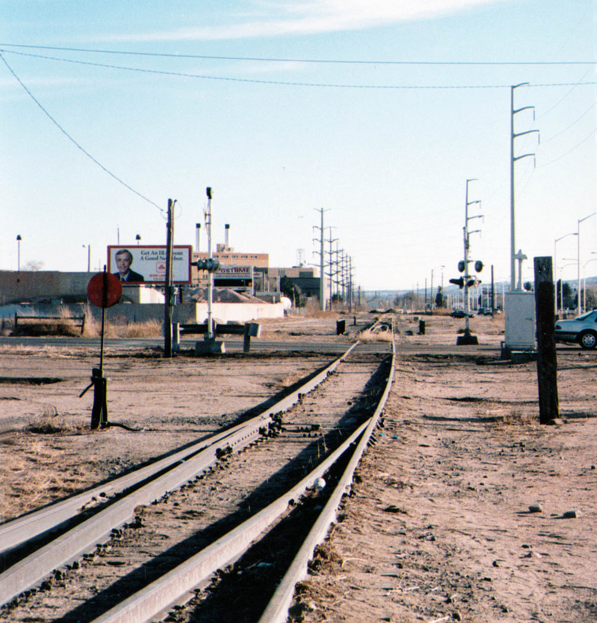
The center lead, ran about a mile and a half north to above Nichols Blvd. It split into two leads 
just north of Fillmore St. The Timken complex was completely gone when this satellite view was 
taken, as was the concrete block manufacturer.
 
This 1965 aerial shows the center Rock Island lead curving north to cross Fillmore St, with Timken occupying 
the arched roof building at center right. Across the track is Carter Carburetors in the building with the white roof. 
Their spur has already been removed. Across the top of the frame is the RI west lead curving to run beside 
the Santa Fe, with the Amoco bulk plant at the edge of the frame.
 
Here's the view north from Fillmore St on the peninsula. I don't have room to fit Timken below Fillmore, 
and the first building north of Fillmore is already Everitt. Above there I am basing the lead mostly on the
eastern fork. First up on the right is Alpine Roofing, based on the the Roofers Mart wholesale operation.
  
 
Beyond Alpine on the same spur will be the machine company. It's an interesting looking building with a center 
clearstory, and a boom and hoist projecting over the track for lifting heavy loads and getting them into the building.


 - ~ -
 
 Across the track from the machine company is a nondescript modern sheet metal building. I plan to relocate 
Hexol Chemical here and have mocked up two ideas for a more substantial structure to house it. Buildings with 
arched roofs like this are fairly common in this area. I envision boxcar spots to the left, with a tank car spot to 
the right. I think the longer building parallel to the track better fits the center view block plan.


 - ~ -
 
At the end of the east customer spur at 4th Street is the PPG distributor, another example of a low-rise building 
with an arched or barrel roof common to a certain era, especially in the West.
 
The building has three dock doors on the track side. 

Across the tracks is a nondescript concrete block building. Stevenson Produce is listed at this address, but the building 
shows no evidence of a dock or doors along the track. Perhaps it has just been renovated, but a block west along 4th Street 
was the Sears warehouse, and I plan to move it to this location.

 The former Sears warehouse clearly has two dock doors along its own customer track.
  - ~ -  

Above 4th St are two last customers. On the east is a plain Jane concrete block warehouse building with 
five dock doors. This building was probably subdivided and recombined to suit multiple tenants over the years. 
Maybe I'll locate Stevenson Produce here so I can spot a mech reefer or two.
 

To the west was one of the busiest customers on the center lead. In 1971 it was occupied by Enresco Inc, 
an agricultural implement dealer, but later it housed a waste cardboard and paper collection and shipping concern. 
Today it is operated by Waste Management. I'll just bill it as a larger City Waste Paper facility than the one adjacent 
to the ATSF yard downtown. The building is another of those precast concrete twin-fin tilt-up structures, with two spots 
along the open dock and another three along the enclosed section.  

Here's a shot with a couple boxcars spotted for loading, and here's a shot of D&RGW 3129 switching the dock in 2003.
 
  - ~ -  
 
So that in a nutshell is the Roswell industrial park served the Rock Island as I would build it on a peninsula. Combined with the ATSF lead and some staging tracks it would make a great self-contained layout all by itself. In fact, if I was smarter I would have built it first so that I would have something to operate while I built the larger layout, and it would all tie together in the end.
 
As they say, things are always clearer in hindsight. 

Until next time.
 
- ~ - 
 

Sunday, March 2, 2025

Pikeview: Laying out the Santa Fe and Rock Island


Modeling the AT&SF - D&RGW Joint Line through Colorado Springs from Milepost 70 to Milepost 80 circa 1978-1979

- ~ -

Post 12: Pikeview: Laying out the Santa Fe and Rock Island, Part 1

- ~ - 
 

Yet another planning post?

I know, just what I need, yet another diversion, right? But after I mentioned in the Trains and Traffic post that the Rock Island had quite a few customers in an industrial park in Roswell on the north side of the Springs I just couldn't resist dragging out the long sheet of cardboard on which I'd already drawn a plan for that trackage. It is not shown on the layout plan, but the name is there where it could be.

Basically it would be a long, stub-end peninsula coming off the RI staging track along the wall outside the layout room. And it wouldn't just be for the RI tracks to the industrial park, it would also host the isolated piece of the old Santa Fe mainline used as a switching lead to reach several still active customers, giving both switch jobs more work to do.

You can see just how easily my attention wandered, can't you?

Anyway, since I already had a stack of building mock-ups and several drawers of freight cars and locomotives handy from mocking up the rest of the layout, it was all too easy so out they came. At least I was having fun, even if I wasn't laying down track in the staging yards.

So, the physical track layout up at Pikeview looked like this:  

ATSF notes and customers in red, RI notes and customers in light blue

(click on image to enlarge, I suggest you open it in a new window to zoom in)

The vestige of the northbound Santa Fe main is on the west, running 1.4 miles right beside N. Nevada Avenue after crossing over the Rock Island main. That bridge was removed, completely isolating this trackage. To the east is the first of three Rock Island switching leads swinging north off their mainline. It curved sharply and climbed steeply to cross Fillmore Street and run right beside the Santa Fe a short ways before making an S-curve to reach several customers, at one time continuing just under a mile to north of Nichols Blvd. 

To get to their their now isolated track the Santa Fe reached a deal with the Rock Island to use the RI mainline through Roswell, and then the RI switching lead to tie into the old Santa Fe main just below Fillmore Street. In return, the Rock was allowed to use a short stretch of the Santa Fe track across Fillmore, and then divert back onto their own track. This resulted in only one flasher-protected grade crossing across Fillmore, which was being rebuilt and widened at the time. Win-win-win for both railroads and the City.

So what customers justified all this. From the south the Santa Fe served two drywall companies, Building Specialties and Drywall Supply, two petroleum distributors, Amoco and Texaco, a team track, LPG distributor Empire Gas, a branch Transit Mix batch plant, and the Miller beer distributor, High Country Sales.

On the Rock Island lead there was the very large El Paso County Lumber Co. yard (later Brookhart Lmbr, currently Foxworth Galbraith), the smaller Everitt Lumber Co., Pike's Peak Distributing, the Budweiser franchise until it moved over to Russina on the Rio Grande, a couple warehouses, and CSDPU's Birdsall gas-fired power plant, although it didn't get anything in by rail after construction was completed. The lead was then cut back to the lumber yard.

My plan is to model this Santa Fe and Rock Island trackage on one side of a 14 foot long, 36 inch wide peninsula. On the other side will be an amalgamation of the other two Rock Island spurs, but I'll get to that in Part 2. Running down the middle of the peninsula will be a long row of buildings serving as both the rail customers and as a view block to separate the peninsula into two distinct scenes within the same industrial park. These buildings will be finished and detailed for different customers on opposite sides.

And here is what the area looked like on the ground, and what the west side of the peninsula might look like.


Here's our old friend U33B 196 returning light after shoving a cut of lumber cars up the 
switching lead (center) to El Paso County Lmbr. Train 50 was left tied-down on the 
steep mainline (left). In the distance is the Amoco bulk plant served by the Santa Fe, 
branded as Exxon in this 1973 photo.

 Here is the RI switch lead, rebuilt to jog west to connect with the Santa Fe track as it 
approaches Fillmore Street. It used to run straight to the berm at center right.
(photos by Frank Keller) 
 
Looking north up the former ATSF mainline, where the connecting track ties in right 
at Fillmore Street, with a pair of overhead flashing lights but no gates.
 
And here is the same location as modeled on the peninsula.
 
Everitt Lumber had its own spur, the rails still just barely visible in the sand.
 
A bit further north the RI lead jogged east as it entered the El Paso County Lumber Co. yard.  
Here is a view of D&RGW 3100 switching El Paso long after the demise of the Rock.
 
A view inside the lumber yard, with its collection of sheds and stacks of lumber.
 
Here's the south end of the peninsula, showing how the lead will curve off the Rock Island 
main and staging track at the base to cross Fillmore, and then split into separate RI 
and ATSF switching leads.
 
The RI customer spur into El Paso Lmbr will hold up to six cars, making it a very busy rail 
customer, as it still is today. On this side the central row of buildings will be detailed for 
open face lumber storage and shops. The ATSF track runs north, squeezed between the 
lumber yard and N Nevada Ave, which curves west here off the front edge of the peninsula. 
The ATSF Pikeview House and Team Track cuts off here just before the private grade 
crossing into El Paso.
 
The Santa Fe serves El Paso Lmbr using its House and Team Track, but the Rock 
obviously gets the lion's share of the business with its customer spur directly into 
the yard.
 
Beyond the El Paso Lumber yard the Santa Fe had a short passing siding and 
run-around beside the CSDPU Birdsall power plant. It had been removed when 
the photo was taken. In the far distance was ATSF milepost 667 (from Topeka), 
and Pikeview Station.
 
Just past the bridge across Templeton Gap Floodway and the Mount View Lane grade crossing 
is the switch to High Country Sales, the Miller beer distributor and the last active customer 
on the Santa Fe lead.
 
The old mainline continues only a short distance beyond to serve as a switching tail.
 
As you can see the spur to High Country is quite steep and is protected by a derail.
Here is a view of BNSF 2537 switching High Country in 1999.
 
And here is High Country at the end of the peninsula.  
 
Next time we'll look at what the east side of the peninsula might look like.
 
 - ~ -